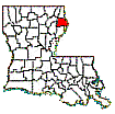
Madison Parish,
Louisiana
Census Data:
When working with census data in Madison
Parish, especially the older censuses, it is important to realize that in the
past various parts of the parish have been included in other parish
censuses. For example, from 1810 to 1830
the northern portion of the parish was part of Ouachita Parish while the
southern portion was located in Concordia Parish.
Madison
Parish was created in 1838 and reduced to its current boundaries in 1861. Prior
to that time it had been a part of the New Orleans District (1721), Ouachita
"County" (1805), Concordia "County" (1809), Warren Parish
(1811), Ouachita and Concordia Parishes (1814) and Carroll Parish (1832).
However, even though a portion of Madison was included in Carroll Parish when
Carroll was formed in 1832, it was never included in a Carroll census. By the
next census in 1840, Madison had been created and was a separate and distinct
unit.
The
maps below should help locate the present day Madison Parish, shown in dark
blue, as it appeared in past years. At times Madison occupied an even larger
area than today. These areas are shown in a lighter blue.
The
1810 and 1820 census data are actual images of the Concordia Parish census taker's form. The 1830 data is an alphabetized listing of
transcribed Concordia data. The 1810, 1820, 1830, 1840, 1850, 1860 and 1870
census indices are alphabetized listings of the Madison (Concordia and
Ouachita) census "index" that show names of heads of household and
the page numbers where the actual images may be found on microfilm. As
additional data is located, it will be included.
The
1850 census images are stored two images per page shown (1) by the page number
and (2) by the page number followed by a. These are reproductions of the
actual census ledgers. First, locate the person in question on the 1850 index.
Then go to the page listed. If the person is not listed on that page, go to the
other image on that page (e.g. 0367 to 0367a).


1810
Census Images - Concordia 1820 Census Images
- Concordia 1830 Census Images - Concordia
1810
Census Index Concordia 1820
Census Index Concordia 1830
Census Index - Concordia
1810 Census
Images Ouachita 1820 Census Images
Ouachita 1830 Census Images
- Ouachita
1810 Census
Index Ouachita 1820
Census Index Ouachita 1830 Census
Index-Ouachita


1840
Madison Census Index
1850
Madison Census Index
1840 Madison Census
Images
(see
readme
file)
(see readme
file
1850 Madison Census
Images
1850 Census
Transcriptions
1850
Madison Slave Index
1850
Madison Slave Images
(see readme
file)
1860 Madison Census
Images (see readme
file)
1860
Madison Census Index
1860 Census
Transcriptions
1860 Madison Slave
Schedule Images (see readme
file)
1860
Madison Slave Schedule Index
1870 Madison
Census Images (see readme
file)
1870
Madison Census Index
1880 Madison
Census Images (see readme
file)
1880
Madison Census Index
1890 Census destroyed by
fire. See 1890
Tax Rolls for 1890 data
1890
Veterans Census
1900 Madison
Parish Census Images (see readme
file)
1900
Madison Census Index
1900 Census
Transcriptions
1910 Madison
Parish Census Images (see readme
file)
1910
Madison Census Index
1910 Census
Transcriptions
1920 Madison Parish
Census Images (see readme
file)
1920
Madison Census Index
1920 Census
Transcriptions
1930 Madison
Parish Census Images (see readme
file)
1930
Madison Census Index
1930 Madison Census
Transcriptions
1940
Madison Census Images
1940
Madison Census Index
Miscellaneous Charts
Farm Size
Distribution 1850-1950
Farmland
1840-1950 -- Acreage
Population
1840-2000 w/ % Nonwhite
Population
1840-2000 Racial Makeup
Population
1840-2000 Racial %
Return to Madison Home Page
© 2012 Richard P. Sevier (dicksevier@gmail.com)


