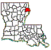
MADISON PARISH MAPS
All information contained within this site is made available to the
public at no charge for viewing only. IMPORTANT
- A portion of the following material (Madison Parish East & West) was
extracted from Madison Parish Tax Rolls 1879 & 1881, by Richard P.
Sevier, and appears on Madison Parish, LAGenWeb with his permission. This
material is copyrighted. The file may not reproduced by any means, including
electronic, without express written consent of the author.
NOTE: Additional maps that show portions of Madison Parish may be found
on the Louisiana Historical
Map site and the Mississippi
Historical Map site
A current PDF formatted copy of the Madison Parish State Highway Map may be viewed or downloaded by first clicking here, then scrolling to the bottom of the page and clicking on “Accept.” Then scroll down to “Parish Maps” and click on the Madison Parish map.
Click on Pictures to Enlarge

World Madison Map Made Using Mapcite
Interesting Map showing where people live who have accessed the Madison Historical Website from cities outside the United States from mid-2007 to mid-2013 and from United States cities from June 1, 2012 to June 1, 2013

US Madison Map Made Using Mapcite
More-detailed Map showing where people live who have accessed the Madison Historical Website from US cities during the 12 month period June 1, 2012 to June 1 2013

Shows the route of Grant's march through Madison Parish on his way to
Vicksburg


Madison's
Historic Boundaries - (includes parishes from which Madison was derived -
Concordia and Ouachita)
Madison
Parish Patentee Map Index These are color-coded maps showing
properties bought from the US General Land Office (GLO) by Madison Parish’s
earliest landowners. Most of these tracts were purchased during the middle
1800’s. Each township is mapped separately on the original 1820-1830 surveys.
Each tract shows the original owner and the date the tract was purchased. The
individual maps are hyperlinked to the Index
which shows the entire parish. The map to the left is an example of the
township maps. It shows the original landowners in Township 15 North - Range 13
East. Click on it (maybe twice) to enlarge it. Twenty-six townships are
available from Township 14 North - Range 9 East in the
southwestern part of the parish through Township 18 North - Range 14 East in
the northeastern part. For more on this and a list of the
original landowners click here.

Madison Parish 1848 From "La Tourrette's
reference map of the state of Louisiana: from the original surveys of the
United States, which show the townships, sections, or mile squares, Spanish
grants, settlement rights & c., also the plantations with the owners names
engraved thereon / compiled and published by John La Tourrette,
New Orleans, LA. ; designed and engraved by Peter J. Grassner, A.D. 1848." From Library
of Congress.

Madison Parish 1853 From La Tourrette's
1853 map as described above.

Madison
Parish 1862 From Library of Congress.

Madison
Parish 1862-63 — 2,653k. Confederate military map captured by Union forces
during 1862-63. Map shows plantation owners, abandoned plantations, roads,
villages, rivers, etc. Probably a forerunner of the Grant’s March
map
above. Also shows portions of Carroll and
Richland Parishes. Courtesy of the USGS National Wetlands
Research Center. Click here
for smaller version.

Detailed (7.5’
Quads) Madison Parish Topographic Maps

Early
1800's map showing first landowners (patentees) of Madison Parish. NOTE:
For more details on this see Madison Parish Patentee Map Index above.

Detailed
1875 Plantation and Ownership Map (From 1875 Tax Records)

1891
Plantation and Ownership Map (From
library of Congress)

Detailed
1903 Plantation and Ownership Map, (From 1903 Tax Records)
NOTE: The 1903 map was made primarily to show the vast holdings (shown in
red) of the 70,000 acre Ashly Co. Ltd of Dundee, Scotland. Unfortunately, due
to the many land description mistakes and omissions in the 1903 tax rolls, some
property locations may be totally unreliable.

Detailed
1943 Plantation and Ownership Map, (From 1943 Tax Records)

Detailed
1979 Land Ownership Map


Madison Parish (West & East) Showing Plantations as of about 1891


Madison Parish Ward
Map Madison Parish Satellite
Photo

New
Richmond - Originally
to be named "New Richmond" (since "Old" Richmond was
totally destroyed by the yankees
during the Civil War), now the southwestern part of Tallulah. Except on this
land plat, New Richmond never actually existed. Copied from a
Conveyance Record plat in the Madison Parish courthouse.

Richmond First Parish Seat of Madison
Parish.
Burned to the ground by Union troops on June 15, 1863 during the Battle
of Richmond in retribution for Federal
losses at the June 7, 1863
Battle
of Milliken’s Bend. Courtesy of Louis Buckner, Tallulah,
LA.

1927
Mississippi River Flood Distribution of flood waters in Madison
Parish. Prepared by the U. S. Coast and
Geodetic Survey from data supplied by the U. S. Army Corps of Engineers.
Courtesy of Brad
Edmondson, Ithaca, NY.
© 2017 Richard P. Sevier


