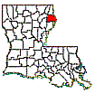
MADISON PARISH PLANTATIONS and LANDOWNERS 1875-1979
Based Upon Tax Roll Data
Richard P. Sevier June
2011
Recently
Wylie Barrow, Tyson Hatch and Heather Baldwin of the U S Geological Survey’s
National Wetlands Research Center in Lafayette supplied Madison Parish Tax Roll
images for most of the years between 1875 and 1943. This data has been combined
with the pre-existing tax roll data from the years 1879-1881 and 1885-1890 to form
a table showing ownership of most plantations at approximate five-year
intervals between 1875 and 1943. Not every plantation is listed; nor did every
piece of property have a name, especially those that had little or no
cultivation. Those that are listed were chosen by their size, historical
significance or length of existence and unique name. The large timber holdings
are listed because of their size even if they weren’t plantations.
Since
the pre-existing tax roll data did not include Non-Resident ownership, the
years 1879-80, 1885-86 and 1889-90 are a combination of the pre-existing
1879-81 and 1885-90 data with the new USGS data, which shows all owners.
Most of
these images are of fairly high quality considering their age, but in some
cases name spelling is questionable due to the quality of the original recorder
and/or the quality of the images. Unfortunately the 1908 Non-Resident images
were illegible as were a few others. Non-resident owners are shown with a light
green background. However this seems to be inconsistent, and, starting about
1928, few owners were identified as Non-Resident. In fact in 1943 none of the
owners were separately-listed as Non-Resident.
The
original table was so large that it was very easy to get “lost”, because the
identifying row and column headings, showing name or date, disappeared as the
table was scrolled down or to the right. To somewhat alleviate this, the table
has been broken into eight smaller tables by plantation name, however scrolling
to the right must still be done to see the dates. More than 75 plantations are
listed.
Many plantations do not show up every year. They may have been merged with other plantations, or the plantation name just may not have been listed or the image may have been illegible. In particular, Trinidad was especially difficult because the three original plantation names were Good Hope, Oak Ridge and Waterford (1875-1894), then later merged into Trinidad (1894-1924) and even later returned to their old names (1930 on.)
Interestingly enough several plantations have more that one location. There are three totally different locations for Sharkey. California and Wyoming both have two different locations. There are probably more.
Plantation
Names, Owners, Acreage and Dates are shown below:
Algodon to Banner
Bozeman-Lum to Cottage Oaks
Crescent to
Evergreen
Ex Via to Huon
India to
Maryland
Montrose to
Point Clear
Richland to
Stockland
Talla Bena to Zululand
Click on the maps below to see a detailed view of Madison Parish plantation locations, landowners, names and most property containing at least 160 contiguous acres. Maps have had the section lines along the Mississippi River restored to their circa 1830 locations. After the map downloads, click again to enlarge it. (Maps are large downloads.) Due to the small-scale maps and quality of the source material, land ownership lines in many instances are only approximate. Acreage on all three maps is plotted on a recent (post 2000) Madison Parish Highway Map base.

Early 1800's Map Showing Original Landowners (Patentees)

1875 Plantation & Land Ownership Map

1891 Plantation and Landowner Map

1903 Plantation & Ownership Map
NOTE: The 1903 map was made primarily to show the vast holdings (shown in red) of the 70,000 acre Ashly Co. Ltd of Dundee,
Scotland. Unfortunately, due to the many land description mistakes and
omissions in the 1903 tax rolls, some property locations may be totally
unreliable.

1943 Plantation & Land Ownership Map
Who
is viewing these Madison Parish Plantation Maps?
The following two
maps show the locations of those who have been interested enough to view
Madison Parish Plantation data during the period July 2011 thru 2014. It is
interesting to note that people from all over the world have accessed these
maps. The first map is a detail of the United States, while the second map
shows the entire world.

US Madison Plantation-owner
Visitors Map July 2011-2014 Made Using Mapcite

World Madison Plantation-owner Visitors Map July 2011-2014 Made Using Mapcite


